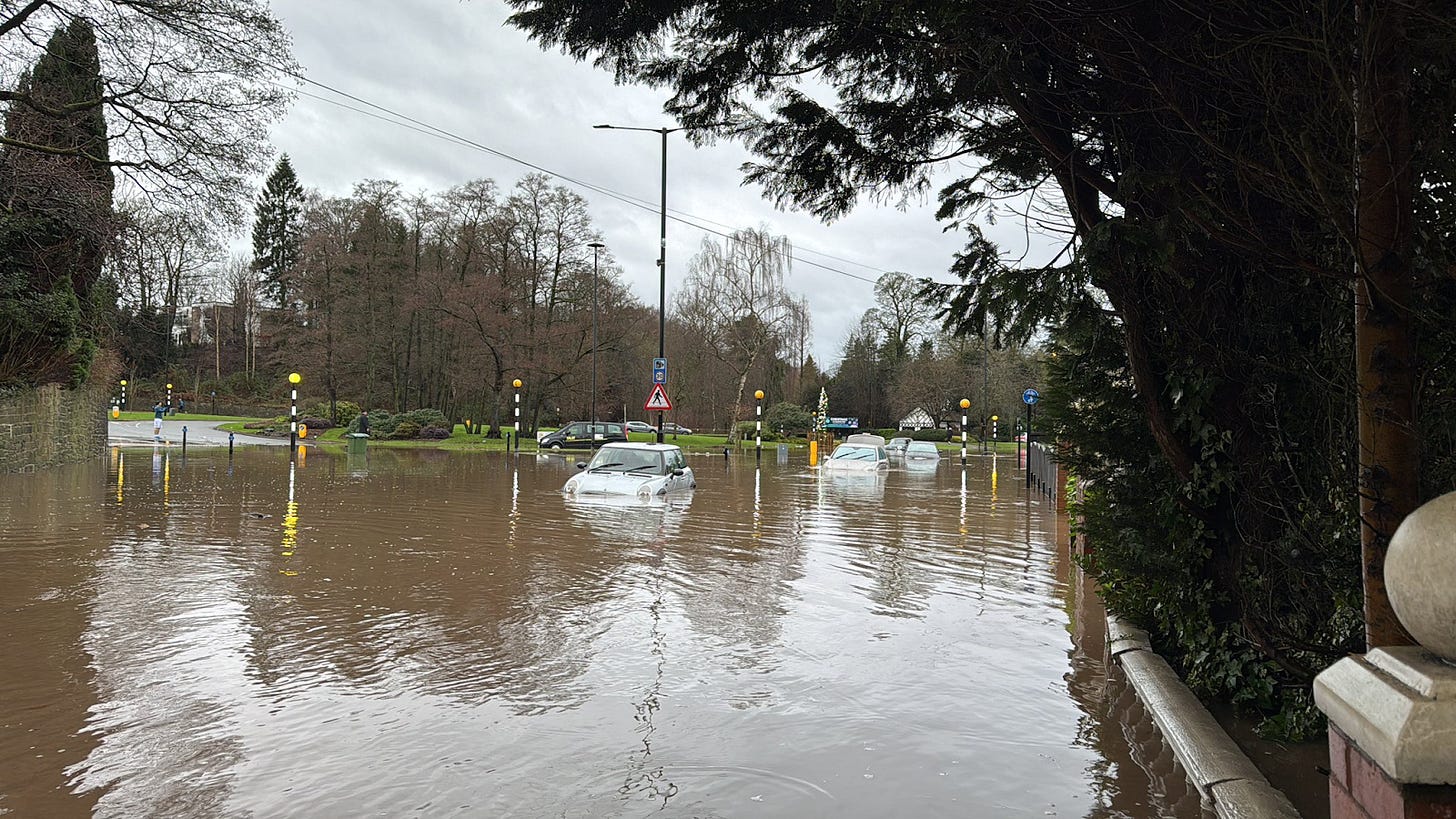
Andrew Simcock, the local councillor for Didsbury East, thought he knew floods. Over two consecutive years, the town witnessed incidents of such heavy flooding that they were considered once-in-a-century probabilities. The extraordinary had become routine. But on New Year's Day this year, as he hurried to update residents of the rising water levels in the Mersey via a Whatsapp Group he had set up, he realised maybe he didn’t know floods. “I was here when the floods happened in January 2021,” he says. “[and] at the flood centre in 2022. I’m ideally placed to tell you: the amount of water and the speed it rose this time was far more significant than those two events.”
The River Mersey’s water levels near Didsbury leapt some four metres, to around 7.66m, after torrential rainfall between 31 December and 1 January. For context, that’s higher than the record of 7.23m, set during 2022’s flood.
Four hours after fireworks had been let off in St Peter’s Square to celebrate the new year, Manchester City Council leader Bev Craig was still awake, taking updates on what was by then a major incident. Hundreds were being evacuated from a refugee hotel, electricity was cut off to hundreds of homes and Didsbury Mosque had become a place of refuge for those fleeing the water.
The flooding posed questions about how prepared Greater Manchester was to deal with the consequences of the climate emergency. It also made us wonder: what changes could be made to the city region in the future to become more resilient to these events?

The Greater Manchester response to a flood doesn’t begin here at all. Instead, it starts in the Met Office’s forecasting office in Exeter, where the Environment Agency – a national body that does what it says on the tin – has desks, alongside the Met office tracking weather forecasts. They produce daily flood guidance statements sent to local authorities and emergency services, and when the likelihood of flooding escalates, a multi-agency response kicks in. Police run the operation, evaluating the severity of the incident and directing the response with partners like councils, fire services and local Environment Agency staff.
“I mean, this is something we’re actually quite good at as a country, in terms of flood response,” says David Throup, flood expert and former area manager for the environment agency in Herefordshire. Each individual agency has its own responsibilities. The police lead the operation, fire and rescue teams respond to emergency incidents, councils communicate updates to their residents and the Environment Agency monitor the flooding, sending out alerts and operating sluice gates that redirect water into basins. There is one such basin in Didsbury with the volumetric capacity of 310 Olympic swimming pools.
Other flood defences in the city region include a storage basin in Salford that has the capacity of 250 Olympic swimming pools, which defends some 2,000 homes. There are new flood defences — including a new basin and raised walls — planned in Rochdale and Littleborough, although construction won’t start until 2027. 2.5km of defences, designed to protect 870 homes, are also set to be built in Bury.
Most of those schemes were put in motion by devastating floods across the city region in 2015. But even with our history of serious flooding, last week’s incident was so rapid that agencies were caught by surprise. Streets in Didsbury that run beside the river — like Morningside Drive and Merston Drive — hadn’t had flood alerts, according to Simcock.
Residents continue to question how late the sluice gates that redirect the water into the flood basin by Fletcher Moss park were opened. Simcock says, compared to 2021 — when gullies (the passageways attached to drains) were cleared and houses knocked on by agency workers throughout the night — there seemed to be a lack of knowledge about the situation as it emerged.
It was frustrating: “There was “a general sense of: ‘what is going on? Where are the alerts?’” explains Simcock, who was left to message updates to residents in a Whatsapp group chat. Following complaints from residents, the Environment Agency insisted they did their job, but the MEN reported that, while they sent out six flood warnings, they missed some areas that were later flooded.

Didsbury wasn’t the only area affected, with floods across the city region, including in Stockport, Wigan and Tameside (where local councillor Steven Barton tells me he was clearing drains by hand). Over 1,000 people were evacuated from their homes by fire and rescue services. “We were all taken by surprise by some degree,” said Andy Burnham. “There was no named storm. There was not a particular warning the authorities gave," he said.
But as climate change continues to cause more rain to fall on Greater Manchester — which, rimmed by the Pennines, sits in a natural bowl — events like last week’s will become less and less extraordinary. The city region’s location means the way rainfall lands and gathers can be unpredictable, with water levels rising quickly and events upstream can cause flooding elsewhere. This won’t be helped by Manchester’s climate remaining wet even as the rest of the country becomes drier (something which has been forecasted by the Royal Horticulture Society).
“I was shocked like everyone else, but I wasn’t surprised,” says Stephen O’Malley, the co-founder of Civic Engineers, “the threat, the occurrence of the threat, has been growing steadily over time.” O’Malley’s firm has been pushing for sustainable urban drainage systems (SuDS) and has recently authored a design guide for Transport for Greater Manchester on the topic.
The changes O’Malley suggests aren’t exactly revolutionary: more permeable surfaces, planters and rain gardens. But they could aid Greater Manchester’s mostly Victorian drainage system, which was never designed to handle the amount of water that now falls on the city region (this is the case for most of the UK). These incremental changes seem especially important since rebuilding the sewer system, according to a 2021 report to the GMCA, would be “prohibitive and disruptive”.

As prohibitive as a redesign of the sewer network would be, the end point of what O’Malley and others envision is also tedious. The Civic Engineers co-founder talks about “pivoting away from the sort of space-hungry geometry that’s needed for private car access in particular, and that allows us to place nature-based solutions in an interconnected, systematic way”. Translation: less tarmac, concrete and urban design which prioritises cars and more green, walkable space that absorbs and drains water.
Making these changes could prove challenging in urban, densely-populated areas that are tightly stitched patchworks of land and buildings owned by various people who would all have to agree — and likely be paid — to, say, have a more permeable front lawn. “It’s mind-numblingly complex,” says Throup.
But while it would undoubtedly be complicated, we already know such changes can be carried out. There are already examples of this: like Stretford Town Centre, where a redesign has seen one carriageway’s width halved and segregated cycle lanes installed, along with trees, rain gardens and planters. “It’s that sort of thing that brings that climatic resilience that helps deal with the threat of what Manchester has experienced over the last few days,” says O’Malley.
The city region isn’t ignorant of these solutions. In June 2023, the GMCA approved an ‘Integrated Water Management Plan’ under which the combined authority worked with United Utilities and the Environment agency to prepare the region for a changing climate that will bring more rainfall.
So far, of the £1bn the company has promised to invest in reducing flood risk and improving water quality before 2030, it has spent £480m. Plus, it has co-funded projects across the city region introducing rain gardens and permeable surfaces.
This strategy of changing the way we use land in the city region is echoed by Paul O’Hare, a senior lecturer in geography and development at Manchester Metropolitan University. “It’s not just about climate change, it's about how we build, where we build. Climate change is one part of it but it intersects with lots of other dimensions of urban development,” he says. By this, he’s specifically talking about avoiding building on areas immediately surrounding rivers and setting aside more space for parks and green space to soak up water.

But there is also an argument for scrutinising what is already built. For example, Meadow Mill in Stockport, a converted cotton mill that had its ground floor and carpark flooded. Like many other mills in the city region that have been converted to residential, it lies on the banks of a river — in this case the River Tame — a practical decision when it was built, in terms of powering the mill and transporting materials. Less so now.
The number of mills in Manchester redeveloped into residential properties is of particular importance, because when developers or owners file for the “change of use” of the property, they sometimes get planning without being as heavily scrutinised on flood risk. According to Argemiro Rivera — whose company, Urban Water, consults developers and planners on flood risk and drainage — “the planning is a bit open on that front, so you end up putting people at risk.”
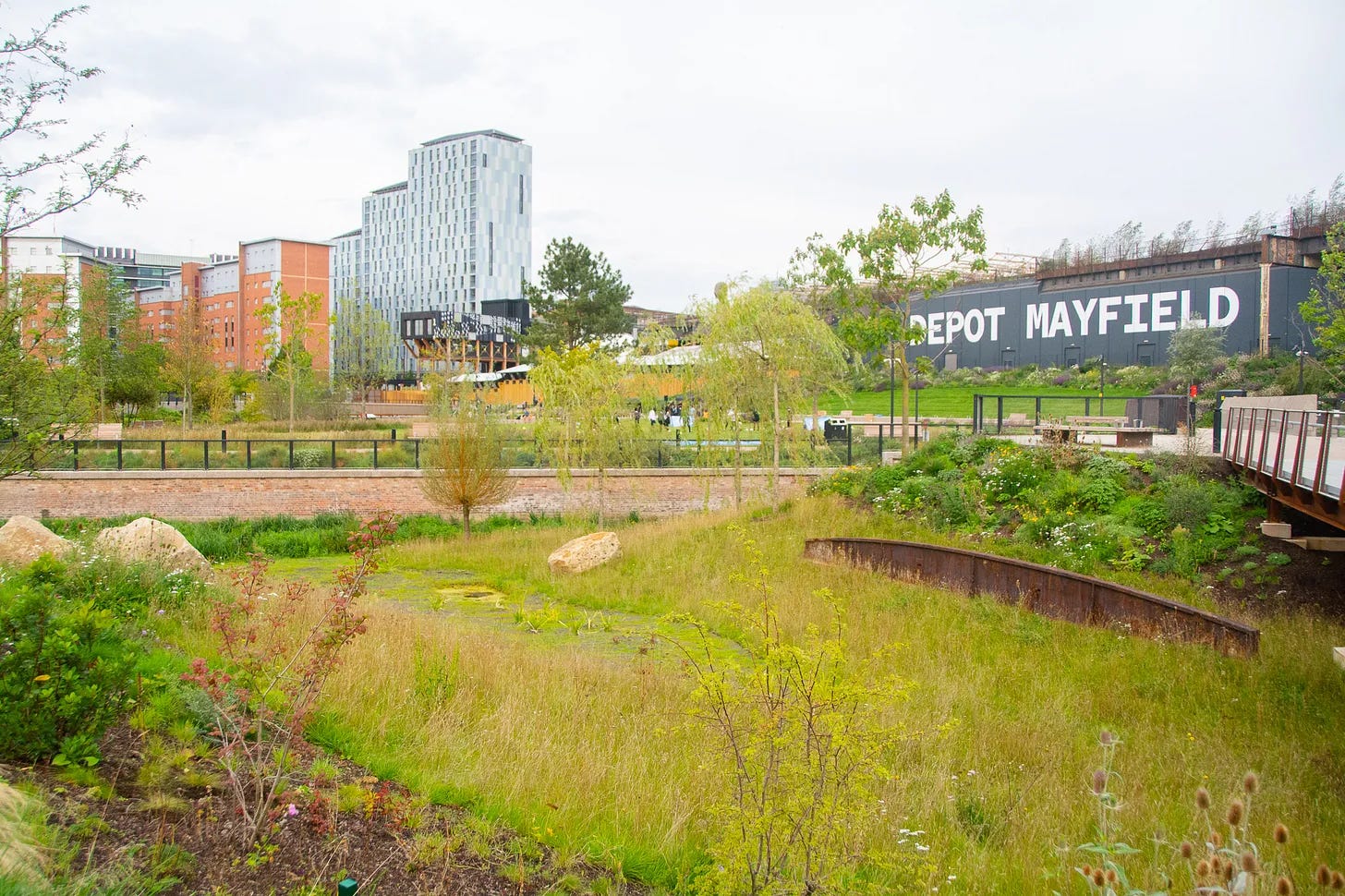
If new developments are going to be built in a flood zone, says O’Malley, they should be done in a way that puts the river at the centre. A good example is the Mayfield neighbourhood, being built around the River Medlock, where Mayfield Park acts as public amenity and flood defence. “The entire footprint of Mayfield regeneration neighbourhood is predicated on the basis that all the water lands on the surface” and then works its way back, via the soil, into the Medlock. Using green space, and sustainable draining as a flood defence works because “in water terms, it effectively consumes its own smoke.”


