
This story was published by The Mill: an award-winning email newsletter that sends you great stories about Greater Manchester. 58,000 people have already joined our mailing list. Just hit that button below to join up for free.
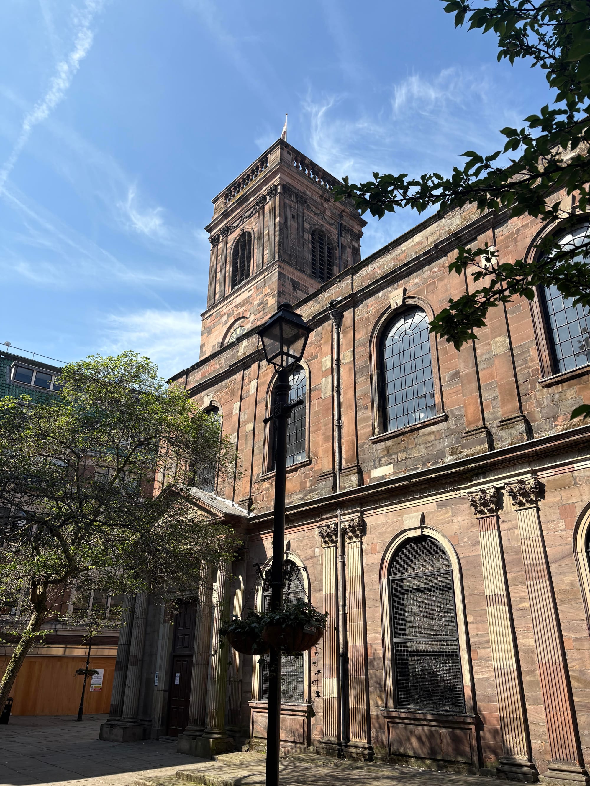
To take a trip back in time — to somewhere so hot as to put the brimstone land of Christian reckoning to shame, so cold as to entomb swathes of the earth in sheets of ice that collapsed to carve vast canyons and gullies miles deep, and so lethal that an extinction event quite literally known as the Great Dying decimated most of the population — go to St Ann’s Church and stop at the door.
Biblical as the above may sound you’ll find nothing inside that speaks of it. Instead, the story of that age is told by the Collyhurst rock the church is made of. Walking around it, you can trace your fingers through striations formed nearly 300 million years ago, in the Early Permian period. Back then, Manchester was a desert just north of the equator, landlocked in the supercontinental mass of Pangaea.
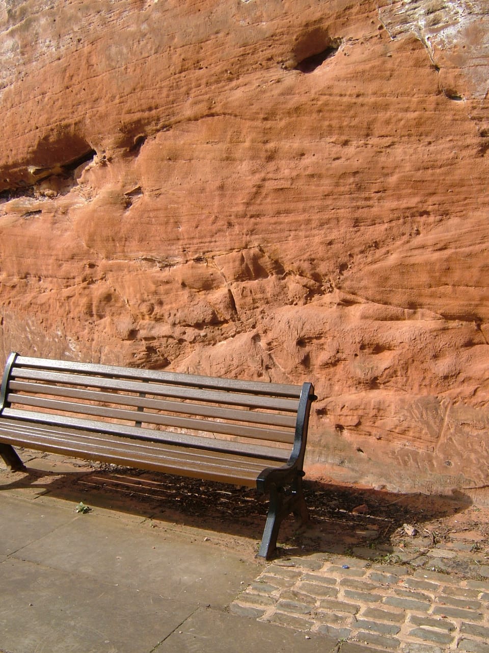
Red sandstone like Collyhurst rock is what much of Manchester is built on. Indeed, Red Bank, up in the north of the city centre, was named after the stone. Were the earth to swallow you whole one day you’d pass first through the layers left by the city’s rapid growth since the Industrial Revolution: fragments of cement, stone, brick, timber, colliery spoil, plastic and glass. This man-made layer is followed by layers of sand and clay left by ancient glaciers and then, at last, you’d reach the sandstone.
By then, you would be passing through something more than earth and rock, but time itself — geological time, deep time. You’d be working your way through rock that was walked by animals and peoples whose very bones are now dust and supported distant civilisations whose ways, languages and ideas are lost entirely.
But there is a man who wants to go on just that journey: Andy Burnham. Last month, at a conference in a former market hall, the mayor was walking the crowd of local politicos and journalists through Greater Manchester’s development strategy for the next ten years. At the end, as attendees started eyeing the bar and wondering when the string quartet was going to start playing Wonderwall, Burnham announced that Transport for Greater Manchester had started exploring options for building a rail network underneath the city region.
It isn’t a new idea, but it is a welcome one. Greater Manchester’s population is growing and is set to grow more, and underground systems are a more efficient way of getting thousands of people around a place without gridlocking it. “We will need infrastructure on a bigger scale to cope,” Burnham told reporters after last month's announcement. Preparatory work started this summer, though the network isn’t expected to be completed by 2050.
This story was published by The Mill: an award-winning email newsletter that sends you great stories about Greater Manchester. 58,000 people have already joined our mailing list. Just hit that button below to join up for free.
It would build out from an underground station at Manchester Piccadilly, originally proposed as part of the now-cancelled HS2 northern spur and since integrated into plans for a high-speed rail line between Manchester and Liverpool. Due to timings, Transport for Greater Manchester couldn’t spare a member of the team leading the underground preparatory work to speak to me. But what will need to be done to prepare the ground, pardon the pun, for an underground network in Greater Manchester?
Holger Kessler is a geoscientist from AtkinsRéalis who, while working for the British Geological Survey, led the building of detailed 3-D subsurface models for Greater Manchester’s stratigraphy (the study of its underground layering of rock). Before any kind of underground excavation or construction could start, geologists would have to carry out what is termed a desk study – gathering all the available information on what exists underground without going underground. “If you’re a geologist, you’ve got a conceptual model in your mind,” he says. “You think: there’s the sandstone, the ice age, I’m expecting this and that.”
The desk studies inform what areas would then be tested and studied further. Boreholes would be drilled and land extracted. Not unlike taking a biopsy from a person, these samples would be studied to better understand the land as a whole. Scans could also be carried out: “Think of a human lying in a CT scanner,” says Kessler. “It's a similar thing.”
Some grounds are better for networks than others. If you think of some of the most famous undergrounds — the London tube, Paris metro or New York subway — they were all built in more consistent ground. Beneath London is a thick, sturdy clay that was ideal for tunnelling. Paris is built on Lutetian limestone and New York on schist, a solid metamorphic rock. These geologies are part of the reason these cities were able to build undergrounds sooner with less complex, and expensive, techniques.
Greater Manchester’s geology has more variation. There are more faults — dislocations in the rock — formed by minor earthquakes in the early 2000s and the legacy of coal mining. The unmined coal further out toward the Pennines will also likely affect the route the tunnels can take. “The geology goes on and on,” Kessler says. “Sometimes, people think there is a point where it will just stop, become space. But it doesn’t. Some of the coal measures go down kilometres.”
By no means does all this make an underground network impossible for Manchester, just more complex. But, beyond geology, there is also the question of what has already been built under Manchester.
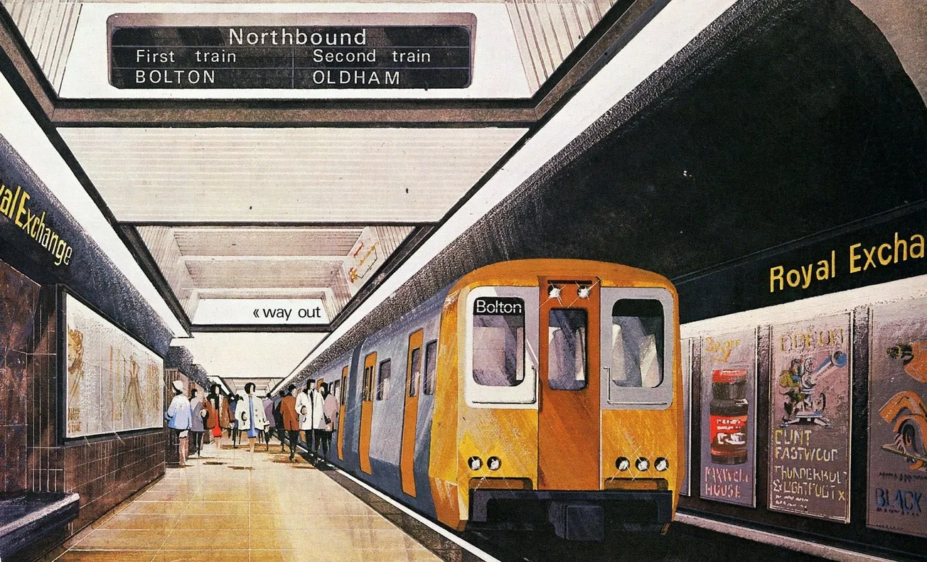
When the Greater Manchester County Council (a predecessor to the Greater Manchester Combined Authority) was formed in 1974, it inherited a plan originally conceived by Manchester City Council for an underground rail link connecting the north and south of Greater Manchester via Victoria and Piccadilly Stations.
The line, called the Picc-Vic tunnel, was never built (you can read our in-depth story on why). Despite other regions like Newcastle and Liverpool taking advantage of changes to the law that gave them access for funding for big projects, Manchester missed out. Richard Brook, a Professor in Architecture at Lancaster University who hosted an exhibition on Manchester’s grand projects in 2012, told me the Picc-Vic fizzled out because of the coalescence of the oil crisis in 1973 and the shift of senior staff working on the proposal at Manchester City Council to the newly formed GMC in 1974. “I think, in that melee, the project lost a champion. No one was pushing it, driving it through.”
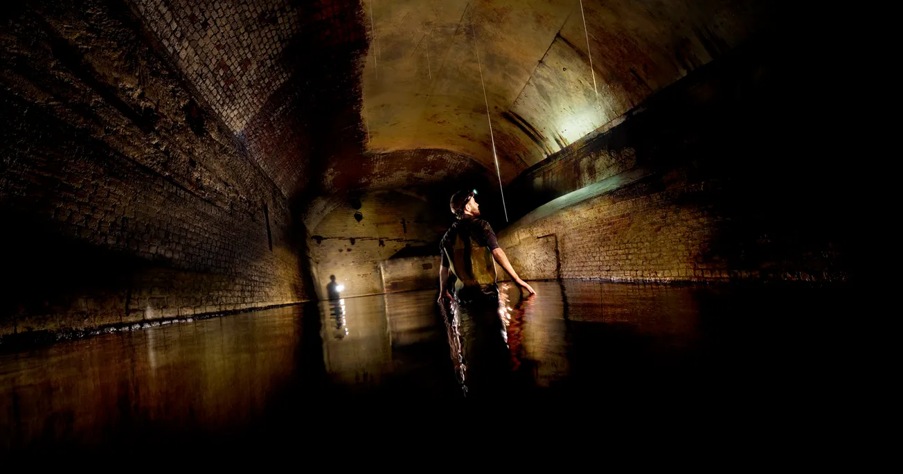
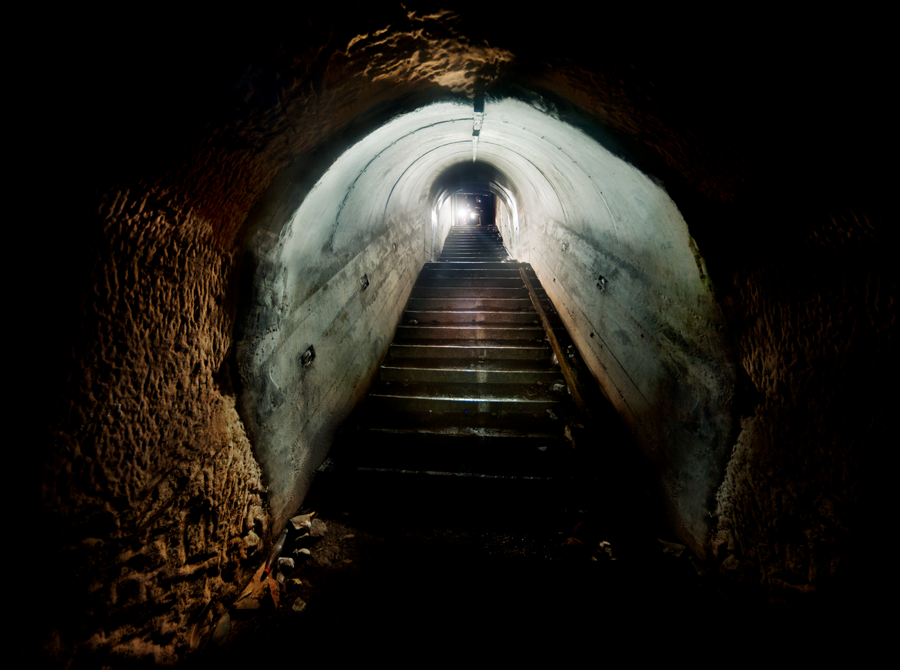
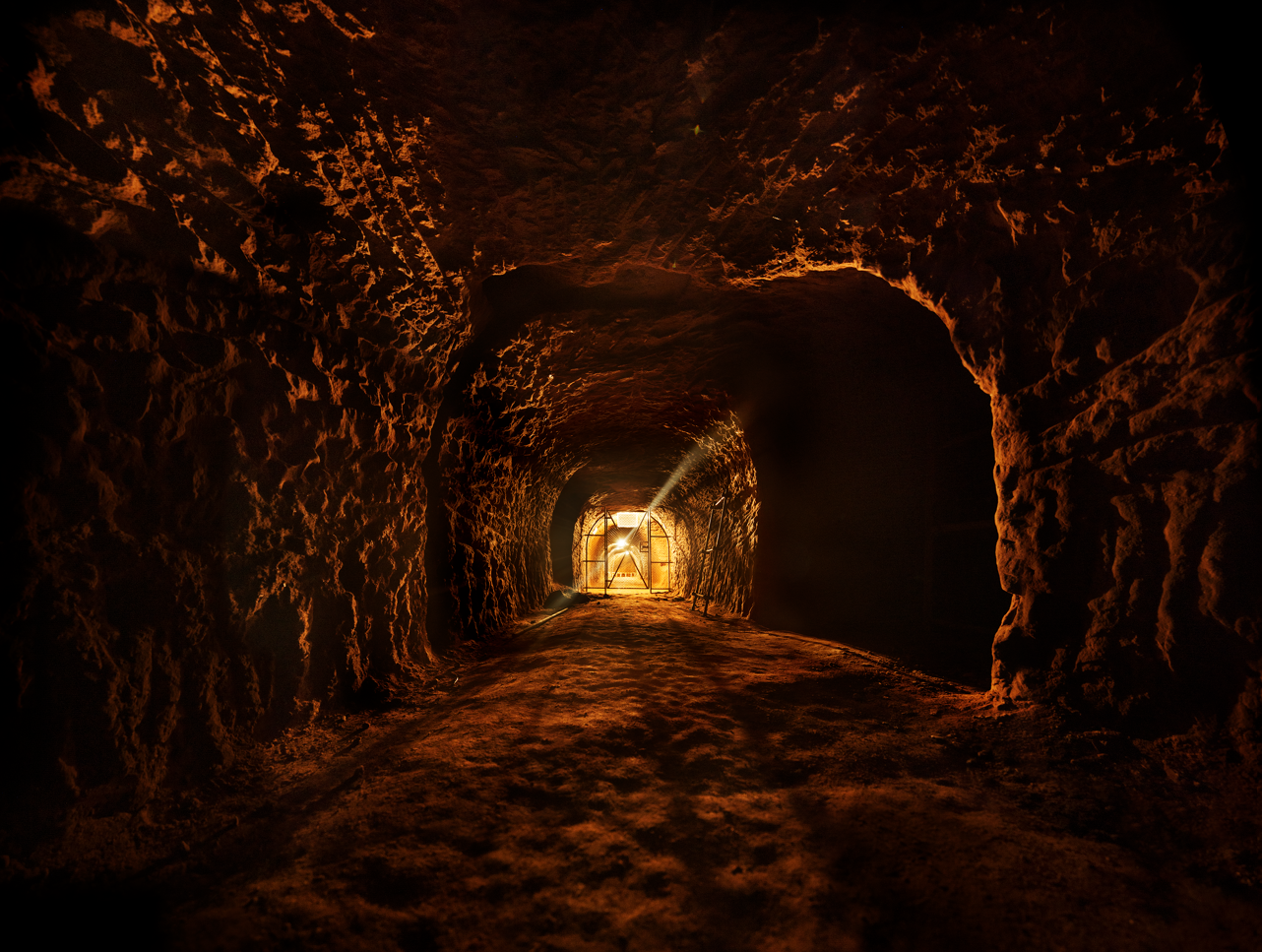
Engineers working on the proposals had to sign the Official Secrets Act because in order to do their studies they had to know the exact location and depth of the Guardian Underground Telephone Exchange (GUTE). This network of reinforced concrete tunnels was built in 1958 amidst deepening anxieties about the Cold War, and communicated with other exchanges in Birmingham and London. They were designed to provide back-up communication in the event of nuclear disaster but by the time they were complete the warheads had already advanced beyond them.
Robin Grayson was a councillor at the GMC in the 70s, and remembers a Transport Strategy Committee meeting in the GMC offices off Portland Street convened to discuss the slow progress of the Picc-Vic project. There were issues finding a suitable route and depth. “The officers would say, ‘why can’t it go this way?’,” Grayson, speaking to me on the phone, remembers. But a consultant engineer from UMIST told them that wouldn’t be possible, and the reason why was always the same. “Another would say ‘what about this way?’” Grayson recalls. “Deep cables,” the engineer said again.
A route was eventually decided, and the tunnel met its official end in 1977. But rumour has it the plexus of cables discussed in Grayson’s meeting sits some 30 metres below ground, almost exactly the level of the proposed Picc-Vic tunnel as it passed under the Town Hall and Royal Exchange.
But back to the rocks. What little drilling was done for the Picc-Vic line found water trapped in the sandstone at around 14 metres under Piccadilly and 10 metres under Victoria. Glaciation over Manchester’s ice ages also created underground channels, essentially valleys under our feet that are filled with gravel and sand that also hold water. But there are ways around this. Engineers could freeze the ground so tunnelling machines can safely drive through these areas, for example.
There is also what is going on at ground level. Building the Picc-Vic in the 70s would have meant going under a virtually desolate city centre in comparison to today’s. Now, Manchester is building skyscrapers at a rapid clip, and their foundations are deep. One developer I spoke to — who keeps a core of sandstone from one of his sites on his desk as a paperweight — said he usually puts 12-18 metre piles under his buildings.
But as these buildings get taller their foundations become deeper. In London, geologists working on Crossrail 2 have developed a clash detection map, so the rail lines will actually go around some building foundations. The underground isn’t treated like land or air. For example, if you built a cluster of skyscrapers around the airport or a park that expands out into a road, people would understandably take issue. But from the perspective of tunnelling engineers, dense building foundations are just as irksome. “Where you’re heading is this classic topic that in cities like Manchester, we should really be safeguarding space in the subsurface for future tunnels,” Kessler says.
Another advantage of developing an underground network – beyond revolutionising local transport — is its exploratory aspect. Even if it were to hamper the project in some way, finding groundwater or even contaminated land in the process means these things can be fixed. “I think if you’re going to construct a network like that you have to get as much value out of it as you can,” says Stephen O’Malley, co-founder of consultancy Civic Engineers.
And the millions of cubic metres of land the excavation will bring up can also be put to good use — rather than going into landfill. Look at the Wallasea Island Project, where the land excavated as part of the construction of the Elizabeth line was used to build a nature reserve off the east Essex coast.
While, right now, Burnham’s ambition remains mostly just ambition (costings or financing plans are to be seen), an underground network won’t just be a way of controlling how the city region’s ballooning population gets around. It’s an opportunity to see, quite literally, what Greater Manchester is made of.
Andrew Brooks, who shot most of the photos in this story, has an exhibition running at the Portico Library, a collaboration with the poet Ian McMillan "about the streets where we live in the early hours of the morning".
This story was published by The Mill: an award-winning email newsletter that sends you great stories about Greater Manchester. 58,000 people have already joined our mailing list. Just hit that button below to join up for free.